The Joy of the Chase: Collecting Old Irish Maps
By Thomas McGrath, Jr.
Presented at the University of Notre Dame
Rare Book Room, Hesburgh Library
on March 29, 1993
Like novels, maps are exciting, image producing segments of our culture and I am here to present that thought. I thank Bob Miller, Director of the University Libraries, for this opportunity to talk to the Friends of the Library as well as for his past kindnesses. May I also thank Laura Fuderer, the rare book custodian here at Notre Dame, for her kind hospitality past and present.
"The Joy of the Chase: Collecting Old Irish Maps" is the theme of my talk tonight. I wish I had thought of that title but the Friends of the Library at Notre Dame assigned it to me.
To have a chase you need both a hunter and his quarry. I was the happy hunter who so enjoyed chasing down his quarry of old Irish maps. Hunters are often aided by bird dogs. I was aided by map sellers here and in Europe. My chase began in the summer of 1947 on a training cruise to Europe with the Brigade of Midshipmen at the United States Naval Academy in Annapolis, Maryland. It has yet to end.
During World War II, I enlisted in the United States Navy as soon as I turned 17. While waiting to be called to active duty, I studied chemical engineering for one year here at Notre Dame. In the late spring of 1945 I left this great university, never to return as a student, in order to go through the Navy "boot camp" up at the Great Lakes Naval Training Station. I later entered the United States Naval Academy from which I graduated with the Class of 1950 to serve during the next four years as an officer in the Atlantic and Pacific fleets.
While at the Naval Academy, the brigade of midshipmen embarked on three summer training cruises to Europe during which we practiced at sea the piloting and celestial navigation skills acquired in the classrooms at Annapolis. Our stops included Edinburgh, Oslo, Portsmouth, London, Cherbourg, Paris, Nice, Cannes, Monte Carlo, Lisbon, Gibraltar, Tangier, and Guantanamo Bay, Cuba. I was often able to buy an old map while on these trips. In Tangier I bought a small city plan of Algiers which denoted "the place where Christians are sold". I later obtained similar city plans of Antwerp, Stockholm, Malta, Turin, Lisbon, Venice and Naples. We gave all of these city plans along with Revolutionary War maps and old Naval prints to the Army Navy Club on Farragut Square in Washington, D.C. where they now are on permanent display.

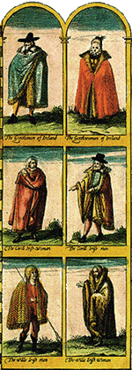
(From The Counties of Britain: A Tudor Atlas by John Speed. New York: Thames & Hudson, 1989, p. 22-3.)
Sea duty as a ship's navigator honed the interest in old sea charts I had developed at the Naval Academy. I pursued my interest in old sea charts and old maps in the various countries I visited while in the Navy. Regardless of the country depicted, I would try, as best I could on a Navy salary, to buy old maps.
However, in order to avoid bankruptcy, I soon restricted my field of collecting to maps and sea charts which showed Ireland standing alone, not as part of Great Britain or of Europe.
During the 1980s I traveled fairly frequently to Europe in trying to persuade automobile manufacturers to install safety air bags in their motor vehicles. I found treasure troves of old Irish maps and sea charts in Ireland, England and Germany. In most large European cities sellers of old prints are likely to have old maps for sale also. In London and Munich there are dealers who only buy and sell old maps.
Always on the prowl, I once searched for old Irish maps in Gothenburg, Sweden. Unsuccessful on that trail, I was yet able to buy a 1798 engraving of George Washington. It now hangs in the Washington Room of the Army Navy Club along with a 1796 engraving of the Battle of Bunker Hill that I purchased in Boston. Both engravings were published by A.C. dePoggi in London and are after Trumbull's famous paintings of those subjects.
Why collect old maps of Ireland, you may ask? Well, I am of Irish blood, I studied at Notre Dame, and Ireland was unique in that it remained for centuries the westernmost land known to the ancients. So far out on the known periphery of nations was Ireland that it never became part of the great Roman Empire.
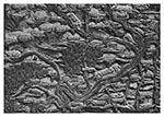

(From Woodward, David, ed. Five Centuries of map printing. Chicago: University of Chicago Press, 1975, p. 31 and p. 54.)
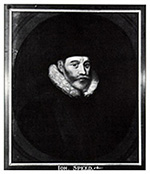
from his Atlas.
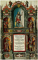
(From The Counties of Britain: A Tudor Atlas by John Speed. New York: Thames and Hudson, 1989, p. 11 and p. 2.)
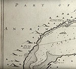
Where to begin this discussion of the Irish maps and sea charts here at Notre Dame? Let's start at what may be close to the end, although I pray that the end is not yet near. In 1991 my wife Betty and I gave to Notre Dame 72 original printed maps of Ireland dating from 1567 to the mid-1700s in memory of Betty's father, David J. Butler, a native Irishman who loved this school. We also gave the university 12 original printed sea charts of Ireland dating from 1584 to 1759 in memory of my parents Thomas and Helen McGrath whose sacrifices permitted me to study here ever so briefly.
Maps were first printed from wood blocks (figure 1) and later from copper plates (figure 2). The paper on which they were printed was hand made and usually water marked. Scholars can identify most maps by their water marks and changes in the printing plate such as cracks or elisions or additions. Maps were often colored by hand and even today you may have an old plain map hand colored.
Maps may be attributed to the surveyor who made the actual measurements of the area depicted by the map, the draftsman of the map itself, the engraver who cut the wood block or copper plate, the publisher or the salesman of the map itself. Maps were sometimes sold singly but most often were put in an atlas for sale. Once a plate was engraved, various issues were struck from the plate while it was yet serviceable. Plates were altered to add information as well as to issue the map under a different name.
Always bear in mind that there are a finite number of these old Irish maps. In most instances the copper plates from which the maps were struck have disappeared. What remains is essentially a fragile piece of paper. Most single maps in existence today are the products of the breaking up of old atlases. The atlases were safeguarded over the centuries in castles, universities, monasteries and the like where they were watched over and protected by generations of dedicated librarians. That these old maps survived wars, fires, floods, dampness and use over these centuries is a direct reflection of the caring efforts of these unknown and uncredited owners and librarians.
Maps might be copied without any acknowledgement of their true source. John Speed, of whom more later, was probably England's greatest cartographer. Speed once wrote:
"I have often stuck my sickle into other men's corne."
The map makers took great pride in the art work on their maps. Elaborate cartouches surrounded map dedications and scales of distances. Seas were stippled and sailing vessels and sea monsters placed on open seas. We were last here in October, 1991 during the Notre Dame Sesquicentennial which highlighted the work of Jonathan Swift, the one time Dean of St. Patricks in Dublin. Dean Swift satirized the map makers of his day in the following lines:
"So geographers, in Afric maps,
With savage pictures fill their gaps,
And, o'er inhabitable downs
Place elephants for want of towns."
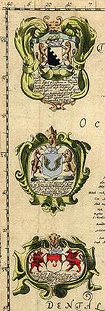
John Speed's (figure 3) Atlas "The Theatre of the Empire of Great Britain" (figure 4) was first issued in 1611 and consisted of four volumes. Volume IV dealt with Ireland and contained five large maps, one of Ireland alone and one each of the four provinces of Leinster, Munster, Connaught and Ulster. R. F. Foster in his "Modern Ireland: 1600-1972" states that "Speed's map of 1610 repeated ... details such as the existence in Ireland of 'islands some full of angels, some full of devils'."
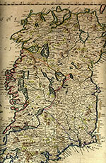
Map of Ireland, 1673.

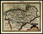
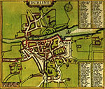
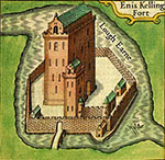
More factually, each of the provincial maps contained an inset of a town plan of a major town in the province. Dublin (figure 5) Cork, Limerick, Galway and the fortress of Ennisfort (figure 6) in the north were depicted in the Speed insets. Ennisfort is the historic castle of the Maguires, also known as Enniskillen. Located on the narrow neck of water connecting Upper and Lower Lake Ernes it remained impregnable until its fall in 1592 to the siege of the amphibious forces of an Elizabethan army. It was soon recaptured by Red Hugh O'Donnell, newly escaped from three years imprisonment in Dublin Castle. The distance scale for these John Speed town plans was in "Pases" (Paces).
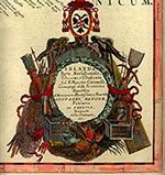
Map dedications were important. The Blome map of Ireland (figure 7) was dedicated (figure 8) to the Right Honorable Charles Boyle. The Boyles were Earls of Cork and one famous scientist, Robert Boyle, the formulator of Boyle's Law in physics, was a member of the family. He was born in Lismore Castle on the Black-water River in County Waterford which castle is usually shown on old Irish maps. We will come back to this area shortly.
The Butler collection includes a small map of Ireland by the Italian map maker Benedetto Bordone dating from an edition of 1567 which has been described as the first printed map of Ireland alone (figure 9). Incidentally, there was significant early sea trading between Ireland and Italy. As early as the 15th century there was an Irish hospital in Genoa.
The Butler collection includes a complete set of early folio Mercator maps of Ireland from his 1606 edition (figure 10). Gerard Mercator was probably the greatest of all cartographers. A maker of world globes and scientific instruments, an engraver and cosmographer, a mathematician and skilled calligrapher, an astronomer and philosopher, Mercator also gave the name "America" to the new world. He freed map makers from the trapezoidal projections of the Alexandrian Greek geographer Ptolemy which had lasted from the 2nd century A.D. to the 16th century. His Mercator projections which we recall from our own school days eased the task of navigators because a straight line on a Mercator map represented a great circle course at sea.
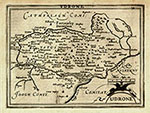
The Butler collection also includes a complete set of Mercator miniature maps (figure 11). In both large and small atlases Mercator included a map of a place called Vdrone (Udrone) in his set of Irish maps. The reason for this arises from the adventures of an English freebooter by the name of Sir Peter Carew. When Queen Elizabeth forced Gerald Fitzgerald, Earl of Desmond, to renounce all his rights to family lands in Munster, Peter Carew, relying upon some possible relationship to the Fitzgeralds, claimed large land holdings in Ireland. Pressing his claims at Dublin Castle, the seat of English power in Ireland, he was awarded title to the Barony of Vdrone. He then claimed title to one half the Kingdom of Cork. He continued on claiming territory throughout Desmond Munster and MacCarthy Musketry. His success in pressing the vacuous claims was such as to rate a map all to himself from the great Mercator!
The hunting adage that a bird in hand is worth two in the bush applies to map collecting. If I came across a single map belonging to a set of maps, I normally would buy it hoping that I could complete the set at a later date. For instance, the Butler collection includes a 1595 map of the southern half of Ireland by a great Italian globe and map maker Vincenzo Coronelli (figure 12). I know I will find its mate, the northern half by Coronelli some day and the set will then be rejoined here at Notre Dame. By the way Vincenzo Coronelli was the Superior of the Franciscans and cartographer to both the Republic of Venice and the King of France.
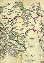
Another example of this adage is the 1685 map of the "Queens County" by Sir William Petty in the university library (figure 13). It is but one of the Irish counties in Petty's Atlas which was the first printed Atlas of Ireland and derived from his famous "Down Survey" of 1565-66. William Petty was the Physician General of Oliver Cromwell's army which invaded Ireland in 1649. His survey was made in order to parcel out estates confiscated from Catholics to the victorious Cromwell army. Petty supposedly made maps of Ireland's 214 Baronies in two sets. The first set was stolen by pirates en route to London for publishing and the second set disappeared.

Among the sea charts in the McGrath collection here at Notre Dame is one of the Irish coast from Kinsale to Dublin by the Dutchman Lucas Waghenaer. It comes from the first printed sea atlas of 1584 (figure 14). This sea atlas marked the shift of the center of cartography from Italy to the low countries and marked the beginning of a near monopoly in maps and sea charts as Dutch sea power increased to protect its maritime trade.
The McGrath collection includes all of the sea charts dealing with Ireland from "Great Britain's Coasting Pilot" by Sir Greenville Collins who had served in the Royal Navy as a young man. He had been appointed by the Admiralty in 1681 to conduct a complete survey of the coasts of Great Britain. By 1688 Collins had surveyed 120 barbers and stretches of coast land but only 48 charts were used in his sea atlas published in 1693. It was the first complete pilot book of the entire British coast that was published in English.
The Collins chart of Carrickfergus Lough was dedicated:
"To the most Potent and Heroick Prince
WILLIAM III
of Great Britain France and Ireland
KING
Defender of the Faith, etc."


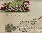
This chart shows the town of Carrickfergus with the notation "King Will Landed 1690" (figure 15). The ship marked with a capital "A" is the royal yacht Mary which carried William of Orange from Chester in England across the Irish Sea to Ireland. The captain of that vessel was no other than Sir Greenville Collins!
Collins' sea chart of Dublin Bay (figure 17) was dedicated "To His Grace James Duke of Ormond, etc" (figure 18). The Dukes and Earls of Ormond were always Butlers. Incidentally, I understand that the present Earl of Ormond lives in Chicago! Strange as it may seem, I tracked down this very sea chart at Marshall Fields in Chicago. I mentioned Lismore Castle down in Waterford County on the Blackwater River earlier. Well just east of Lismore Castle on the river bank lies Affane. It is often shown on old maps marked with the crossed swords indicating a battle was fought there.
On a May morning in 1565 at Affane the Earl of Desmond, Gerald Fitzgerald, brought into battle his Fitzgeralds accompanied by the MacCarthys, the O'Sullivans, the McSheehys and the O'Connors. Opposing Fitzgerald was his boyhood companion Black Tom Butler, the Earl of Ormond, who led his Butlers plus the O'Kennedys, the Gillapatricks and the Burkes. This pitched battle, won by the Butlers, was the last private one fought in Great Britain, infuriated Queen Elizabeth, and led to the forced renunciation by Gerald Fitzgerald of his claims to the historic lands of the Fitzgeralds that I referred to earlier.
As the victorious Butlers prowled the battleground they came across Gerald Fitzgerald lying on his back, a musket ball lodged in his broken hip. The Butlers hoisted him on top of their shoulders and carried him back towards their camp. Taunting Fitzgerald while carrying him away, a Butler screamed out to him "Where now is the mighty Earl of Desmond?" With deep Irish awareness of his hopeless situation while retaining his sharp Irish wit, Gerald Fitzgerald, the Earl of Desmond, shouted back to the Butlers "Where he belongs - on the backs of the Butlers."
I do not pretend to be an expert on Irish cartography. There is a fine collection of books and pamphlets on maps and sea charts in the library here at Notre Dame, some of which discuss Irish maps and I commend them to you. There is also a complete collection of a quarterly publication "The Map Collector" here at the library. It contains much general information about old maps. Many map sellers advertise their stock in this magazine. Many of you, I know, share my enthusiasm for cartography, perhaps others will be persuaded to join us.
General RBSC Hours
- Mon - Fri
- 9:30am - 4:30pm
- Sat - Sun
- CLOSED
For exceptions and Hesburgh Library information, view All Library Hours

 |
| 